We Love Where We Live
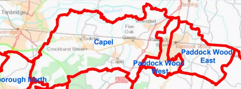
The largest settlement in the Parish is Five Oak Green. The Parish also includes Whetsted, the hamlet of Capel, Castle Hill, Colts Hill, East Capel, Five Oak Green, Tudeley, Postern and Somerhill.
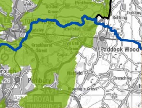
All of the land in Capel is in the Metropolitan Greenbelt (MGB), with much of it also in the High Weald Area of Outstanding Natural Beauty (AONB).
In the 2011 Census, the Parish of Capel had 2,467 residents. The average age of residents was 39.7 years. In total there were 954 household spaces. Of these, 918 had at least one resident.
Residents love the sense of community and the peaceful, rural nature of the Parish. See more about the things we love and the changes we would like to see in the future on our Results page.
A large area adjacent to the west side of Paddock Wood is within the Parish of Capel (East Capel). Large housing developments in East Capel and Tudeley are in the current draft of the Tunbridge Wells Borough Council Local Plan. The East Capel proposed development of 1,500+ houses involves a number of developers. The Tudeley development of 2,800 houses is being proposed by the Hadlow Estate. Tunbridge Wells Borough Council are producing a new draft of the Local Plan, due to be finalised in February 2021 and go out to public consultation in March 2021.
The maps below show:
- The Capel Parish Boundary
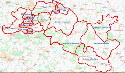
- The Wards that are part of the Borough of Tunbridge Wells.
- Capel’s neighbours in Tonbridge & Malling.
- The Metropolitan Greenbelt (shaded green).
- The High Weald Area of Outstanding Natural Beauty (shaded beige).